
Photo: Chainwit. / Wikimedia Commons (CC BY 4.0)
Wiang Nong Lom: Did a City Really Sink?
Wiang Nong Lom is a broad wetland between Mae Chan and Chiang Saen districts in Chiang Rai, which northern Thais have long said was once the city of Yonok, swallowed by a lake in a single night. Its name already tells the story: lom (ห่฿ลฯม) in the Moradok Lanna dictionary means "deep mud, ground that gives way when you step on it".
We told the full legend in Wiang Nong Lom: The White Eel and the Sunken City. This article belongs to the Fact or Tale series. We take the sunken-city story apart into three layers: what has evidence (documents, soil layers, archaeological surveys), what comes only from the chronicle, and what local tellings, the press and tourism added later. We do not rule on whether it is true; we show where each piece comes from.
What the Legend Says: the Oldest Version We Can Read
The easiest version to read is the Singhanavati chronicle, which the Fine Arts Department translated from a northern Thai manuscript and printed in Prachum Phongsawadan, part 61. Its preface is dated 1936 (BE 2478 in the old way of counting years). Northern Thais call a story like this a tamnan (ตํานาฯ), a tale handed down over a long time.
The chronicle says that in the reign of King Mahachaichana the townspeople went down to the Kukkutanadi, the Kok River, and found a white fish as thick as a palm trunk and about seven fathoms long. They clubbed it to death and dragged it to the king, who had it cut up and shared out to the whole town. At sunset a thunderous, shaking sound was heard; it came again at midnight, and a third time near dawn, louder than ever. Then the town sank into a great lake, leaving only the house of an old mae mai (แม่ห้มฯายฯ), a widow no one had thought to share the fish with.
The words of the text are about sound; they do not name an earthquake. People outside the walls say they heard "something like thunder" all night. Kham Mueang calls thunder fa hong (ฟ้าร้อฯง), and what happens to the town is that it yup (ยุบ), sinks down, and chom (จ฿มฯ), goes under.
- The Singhanavati chronicle as printed by the Fine Arts Department says a white carp.
- The preface of the same book notes that the Yonok Chronicle says a white eel, pa yian pon (ปลฯาอยฯยฯรพอฯร) in Kham Mueang.
- The Yonok Chronicle is the work of Phraya Prachakitkorachak (Chaem Bunnag), who retold Lanna history in central Thai during the reign of King Chulalongkorn. Its white eel became the version most people know today.
The Fine Arts Department's preface also warns readers from the start that the opening parts of old chronicles are often tales, "hard to take as firm evidence": dates, names of people and names of places often disagree. It adds that the translation was made in haste, without time for careful checking. That warning is the first piece of evidence worth keeping in mind.
The Year 1003: a Number That Travelled From Palm Leaf to Science Journal
Many people hear that Yonok sank "in BE 1003" or "in 460 CE". The number comes from the legend itself: the Singhanavati chronicle says King Mahachaichana came to the throne when "the Buddha's religion had passed 1003 years", and the town sank about a year into his reign. A 2017 press release of the Department of Mineral Resources and a 2011 article in Komchadluek quote the year BE 1003 from the Yonok Chronicle too.
The number travelled further than you might think. Teraphan Ornthammarath's 2019 paper in Philosophical Transactions of the Royal Society A writes of "the 460 A.D. earthquake" that drowned Yonok, and says plainly that the year comes from "the available written resources". A table in the same paper gives the event the highest intensity on the scale, following an estimate that Nutalaya and colleagues (1985) made from the words of old documents, but the author also warns that intensities based on chronicles are "highly unreliable".
460 CE is the legend's year. "About 1,500 years ago", which comes next, is an estimate from soil layers. The two look close, but they come from different kinds of evidence. If the legend's year goes into a scientific paper, and the paper is then quoted to prove the legend, we end up back at the same palm-leaf manuscript.
What Lies Under the Lake: the Geology of the Nong Lom Basin
Geologically, Wiang Nong Lom sits beside the Mae Chan fault. The Department of Mineral Resources lists it as an active fault running west to east from Fang and Mae Ai in Chiang Mai province through Mae Chan, Chiang Saen, Doi Luang and Chiang Khong, and on into Laos. Its length depends on what each source counts: about 150 km for the Department, about 140 km for Fenton and colleagues (2003), and 185 km in the 2019 paper, which uses a 118 km stretch for its calculations.
The fault is strike-slip: the ground on either side slides sideways past the other. Fenton and colleagues describe a marshy depression about 14 km long and 5 km wide that stretches south-west from the mouth of the Kok River along the north side of the fault, and read it as a sag basin opened by the fault's movement. The Fine Arts Department's 2023 leaflet on Wiang Nong Lom's heritage also places the basin on the line of the Mae Chan fault.
What is rarely told is how old the lake is. The same Fine Arts leaflet sums up the geology: the area "has been a basin with lake-like standing water from the start", since the Quaternary, from about 2.5 million to about 10,000 years ago. So this nong (หนฯอฯง) held water long before any town stood in the Kok valley. Earthquakes in the past may have made the ground settle or the water spread, but they did not create the whole lake in one night.
Try the map below. Switch the legend, geology, archaeology and measured-earthquake layers on and off, then open the "Time core" tab to set the legend's year beside the soil.
The Trench at Mae Chan: an Earthquake About 1,500 Years Ago
To find an earthquake no one measured, geologists dig a trench across the fault and read the layers of din (ดิ), soil, that have been torn or offset, then date them. The Department of Mineral Resources dug trenches like this on the Mae Chan fault in Mae Chan district, and reported in 2017 that they show several ancient earthquakes, the latest about 1,500 years ago.
In 2019 the Department took journalists to a trench site behind a drinking-water plant at Ban Pong Pa Khaem, Pa Tueng sub-district. MGR Online reported the head of its geohazards division explaining the torn layers and the evidence of a large earthquake about 1,500 years ago, while the deputy director-general said at the same event that the new data still needed comparison and more study, and would go to the Fine Arts Department for checking. Ornthammarath (2019) likewise notes that several studies point to a major earthquake on the Mae Chan fault around 400–500 CE.
The trench shows that this fault once moved hard enough to tear the soil, at a time close to the legend's year. It does not show that a large city sank at Nong Lom, or that it happened in one night. Every age in this section is an estimate. Some news stories give an exact magnitude or brick age, but we found those figures in a single source only, so we leave them out.
Archaeology: 78 Sites and One Bronze Drum
If a large city lay under the lake, archaeologists should find things from its time. The Fine Arts Department's 7th Regional Office in Chiang Mai reports that Wiang Nong Lom covers four sub-districts in two districts: Chan Chwa, Tha Khao Plueak and Chom Sawan in Mae Chan, and Yonok in Chiang Saen. Surveys have recorded 78 sites, abandoned temples and old kilns, but these sites and finds "can be dated only to the Lanna period".
There is one exception: a bronze drum villagers found at Nong Khiao, about 2,000–2,500 years old, reaching back into prehistory. Kham Mueang calls a drum kong (กลฯอฯง). The drum shows that people lived in this basin long ago, but not that they were the townspeople of Yonok in the legend.
The Department adds that Wiang Nong Lom sits on the river route from Chiang Rai down the Kok to Chiang Saen, so the communities here were probably important to Chiang Saen, perhaps for fishing or farming. Since the Chiang Saen chronicle says King Saen Phu built Chiang Saen on an "old town", that old town may have reached as far as Wiang Nong Lom. All of this is the Department's suggestion, not a settled answer.
In 2011 the head of the archaeology group at the Fine Arts office in Chiang Mai told Komchadluek that old objects found in the lake fit the chronicles and the fault line, and people who fish in the lake often find din ki (ดิกี่), bricks, and broken pottery. Still, the Fine Arts Department's latest official summary says that what can be dated is from the Lanna period. For a Yonok older than that, no soil layer or monument has yet confirmed it.
- The Fine Arts Department says scholars have proposed two places, Wiang Nong Lom and Nong Luang in Wiang Chai district. Both are wetlands, but the monuments and finds weigh more towards Wiang Nong Lom.
- Chatlada Sinthuson, a historian from Chiang Saen, told Posttoday (2014) that some point to Chiang Saen Lake instead. Kham Mueang calls a large lake like this a kwan (ค้วฯาฯนฯ).
- The legend itself gives no location beyond a town near the Kok River, so every placing comes from later interpreters.
Earthquakes Measured in Our Time
Upper northern Thailand has had several moderate earthquakes in the past twenty years, and each time the Wiang Nong Lom legend has been told again.
- 16 May 2007: an M6.3 earthquake in Bokeo province, Laos. The Department of Mineral Resources and the 2019 paper attribute it to the Laos section of the Mae Chan fault, the same fault that passes Wiang Nong Lom.
- 24 March 2011: the Tarlay earthquake in Myanmar, on the Nam Ma fault, about M6.8–6.9 (USGS gives 6.9; the study and Thai news use 6.8). It brought the spire of Chedi Luang in Chiang Saen down onto a smaller stupa.
- 5 May 2014: the Mae Lao earthquake in Chiang Rai, M6.1 according to USGS (Thai media reported 6.3 that day), on the Phayao fault, not the Mae Chan fault.
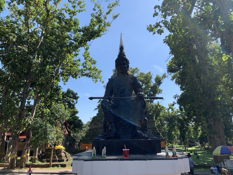
Old stupas are another kind of witness. Ornthammarath (2019) studied the damage these three earthquakes did to Chiang Saen's monuments and found it minor to moderate. He suggests Chiang Saen has probably not shaken harder than intensity VII since the 14th century, and that if the Mae Chan fault produced an earthquake like the one that drowned Yonok in the legend, these stupas "are unlikely to survive". If such an event happened, then, it probably came before these stupas were built.
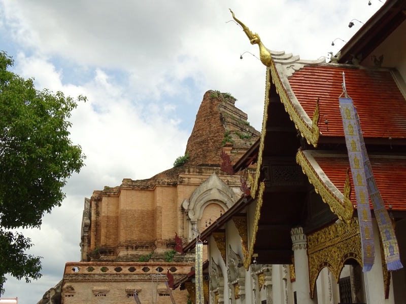
The clearest trace of an earthquake in Lanna records is in Chiang Mai. The 2019 paper and Chatlada Sinthuson in Posttoday (2014) agree that around 1545 (BE 2088) a great earthquake brought down the top of Chedi Luang in Chiang Mai; the ruin you see today dates from it. Kham Mueang calls shaking wai (ไหวฯ).
Khuet, Ill Omens and Why the Legend Is Told This Way
Why does the legend tell a natural disaster as a story about eating a fish? Chatlada Sinthuson explained in Posttoday (2014) that old Lanna saw earthquakes as an ill omen. Chroniclers of the time could not explain the cause, so they often said disaster came because the people or their rulers did wrong, and the town fell. Wiang Nong Lom is one example.
The idea is close to the Kham Mueang word khuet (ขึดฯ), which the dictionary explains as a curse-like taboo that makes things decline. The legend never uses the word, but its plot runs the same way: something unnatural (a giant white fish), something that should not be done (killing it and sharing it out), and a result that falls on the whole town. The one who took no part, the widow the town ignored, survives. Thai Post (2023) reports the local explanation that in those days widows were looked down on and few people mixed with them.
Seen this way, the legend is not competing with geology. They answer different questions. Geology asks when the ground moved and how hard; the legend asks how people should live together.
Fact, Telling or Fiction: Take the Story Apart
Try sorting the Wiang Nong Lom story yourself. The widget below has 13 pieces: tap the box you think fits, then read the reason and the source. The "How the story grew" tab lines up the versions from palm leaf to geopark route; tap "Compare" on two to set them side by side. The map tab shows which places have evidence and which exist only in the telling.
How the Story Grew: From Palm Leaf to Geopark Route
The third layer is what was added after the chronicle, some from local people, some from the press, some from tourism.
- The widow's name and her island. The printed chronicle does not name her, but villagers' tellings recorded by the Cultural Map of Thailand call her Chao Mae Bua Khiao and identify the mound of Wat Pa Mak No in Chan Chwa as Ko Mae Mai, where her house stood. Kham Mueang calls an island ko (โกอฯะ). MGR Online (2019) and Thai Post (2023) tell the same names.
- News after earthquakes. Komchadluek retold the Yonok legend with quotes from the chronicle two days after the Tarlay earthquake (2011), and Posttoday did the same two days after the Mae Lao earthquake (2014). Each time the ground moves, the sunken city comes back.
- The state and tourism. The Department of Mineral Resources took journalists to see the evidence of ancient earthquakes at Mae Chan in 2017, and to both the trench and Wiang Nong Lom in 2019. In 2023 Chiang Rai tested a geopark route called "The fault of old Yonok", which ties the fault and the legend into one trip; Thai Post reports a white eel figure in front of the ordination hall at Wat Pa Mak No.
- The fish. Today almost every telling has the white eel of the Yonok Chronicle; hardly anyone tells the white carp of the Singhanavati chronicle.
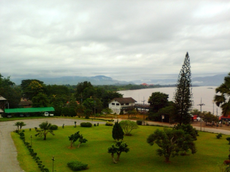
Wat Pa Mak No is a place of meditation: dress modestly and keep quiet. The wetland around the lake is home to many birds and fish. Old objects found here are antiquities; tell the temple or the Fine Arts office rather than taking them.
Common Misunderstandings: What the Sources Show
The Wiang Nong Lom story is so often told alongside science that some sentences sound like conclusions. Here are lines you hear often, and what the sources in this article show.
"Scientists have proved that Yonok sank in an earthquake"
The sources confirm that the Mae Chan fault is active and had a large earthquake about 1,500 years ago. But the Department of Mineral Resources itself says the link to Yonok needs more proof, the Fine Arts Department has found no pre-Lanna monuments in the lake, and the 460 CE date in scientific papers comes from the legend.
"The lake formed in one night"
The geology summarised by the Fine Arts Department says the basin has held lake-like water since the Quaternary, and Fenton and colleagues explain it as a basin opened by long movement on the fault. The lake is older than the legend. Another "town that vanished at once" story is Chiang Mai's; compare Wiang Kum Kam: Did a City Really Drown?
"Every version says it was a white eel"
The Singhanavati chronicle as printed by the Fine Arts Department has a white carp. The white eel comes from the Yonok Chronicle and became the main version later.
"The 2014 Mae Lao earthquake came from the same fault as Wiang Nong Lom"
That earthquake was on the Phayao fault. The instrument-era earthquake on the Mae Chan fault was the one in Laos in 2007.
"A big earthquake like the one in the legend cannot happen again"
The Department of Mineral Resources lists the Mae Chan fault as active and says no one can know in advance when the next earthquake will come. The 2019 paper calculates that this stretch could produce an earthquake of about M7.5, and Fenton and colleagues give a similar maximum. Being prepared matters more than guessing a date.
Summary
- Wiang Nong Lom is a basin that has held water since the Quaternary, beside the still-active Mae Chan fault, which geologists read as a sag opened by the fault.
- Trenches dug by the Department of Mineral Resources show the latest ancient earthquake about 1,500 years ago, close to the legend's year, but 460 CE itself comes from the legend's own dating.
- The Fine Arts Department has recorded 78 sites in the area, all dated to the Lanna period except a bronze drum about 2,000–2,500 years old. No evidence yet shows an older city of Yonok.
- The white carp versus the white eel, the name Chao Mae Bua Khiao and Ko Mae Mai are layers of telling that differ or were added later.
- The legend tells disaster as a matter of wrongdoing and khuet; geology measures how the ground moves. They answer different questions, so we leave the verdict to the reader.
Look up more words from this story in หล่ม ขึด ดินกี่ and ป๋าเหยี่ยนปอน, then read the full legend in Wiang Nong Lom: The White Eel and the Sunken City.
How the city of Yonok began: Singhanavati and the Naga-Built City of Yonok · Chiang Saen and Chiang Rai: Chiang Rai (Jiang Hai): Mangrai's First City · 📚 All of Lanna: Why 'Lanna', not 'Lan Na'? 700 Years in One Song
Lanna stories people still half-believe, taken apart into what is on record, what one teller or text first said, and what was added later.
1. Ma Mia: What's Real, What's Legend, What's Fiction · the Royal Gazette, the 1964 book Phet Lanna and Charan's song: what is on record and what was added later
2. Wang Bua Ban: What's Real, What's Told, What's Tale · the teacher's legend above Huai Kaeo Falls: six tellers, a song, a film and the family's own account
3. Sao Khruea Fa: A True Northern Story or Madame Butterfly? · Prince Narathip's sung play adapted from Madame Butterfly, and why people took it for a true northern story
▸ 4. Wiang Nong Lom: Did a City Really Sink? (you are here) · the chronicle's town that sank in one night, set against the Mae Chan fault, archaeology and measured quakes
5. Wiang Kum Kam: Did a City Really Drown? · King Mangrai's town under the Ping river sand: the Fine Arts digs and the open question of when the sand came
6. Lilit Phra Lo: Real, Legend or Fiction? · Sarong, Wiang Lo and the Kalong river: what the poem says, and how later readers placed its towns on a real map
Sources
- Moradok Lanna dictionary: หล่ม · ขึด · ดินกี่ · หนอง · ต่ำนาน · ป๋าเหยี่ยนปอน · ไหว · ยุบ · จ๋ม · แม่หม้าย · ฟ้าฮ้อง · กว๊าน
- กรมศิลปากร [Fine Arts Department]. (1936). "ตำนานสิงหนวติกุมาร" [The Singhanavati chronicle] and preface. In ประชุมพงศาวดาร ภาคที่ ๖๑ [Prachum Phongsawadan, part 61] (Wikisource)
- ศิลปวัฒนธรรม [Silpa Wattanatham]. คุ้มหลวงเจ้าหลวงล้านนา ... แต่ "พงศาวดารโยนก" แทบไม่กล่าวถึง? [on the Yonok Chronicle and its author]
- วารสารไทยคดีศึกษา [Thai Khadi journal]. Article on Phraya Prachakitkorachak (Chaem Bunnag) and the Yonok Chronicle
- สำนักศิลปากรที่ ๗ เชียงใหม่ [Fine Arts Department, 7th Regional Office]. เมืองโยนก นครในตำนานล้านนา [Yonok, a city of Lanna legend]
- สำนักศิลปากรที่ ๗ เชียงใหม่ [Fine Arts Department, 7th Regional Office]. (2023). มรดกวัฒนธรรมเวียงหนองหล่ม [Cultural heritage of Wiang Nong Lom] (leaflet)
- กรมทรัพยากรธรณี [Department of Mineral Resources]. (24 November 2017). Press release on the Chiang Rai geohazards field trip (in Thai)
- Fenton, C. H., Charusiri, P., & Wood, S. H. (2003). Recent paleoseismic investigations in Northern and Western Thailand. Annals of Geophysics, 46(5)
- Ornthammarath, T. (2019). Seismic damage to ancient monuments in Chiang Saen (Northern Thailand): implication for historical earthquakes in Golden Triangle area. Philosophical Transactions of the Royal Society A, 377
- ผู้จัดการออนไลน์ [MGR Online]. (24 March 2019). "รอยเลื่อนแม่จัน" กับ "โยนกเชียงแสน" [The Mae Chan fault and Yonok Chiang Saen]
- คมชัดลึก [Komchadluek]. (26 March 2011). ย้อนอดีต 1,500 ปี นครโยนกดินไหว [Looking back 1,500 years: the Yonok earthquake]
- โพสต์ทูเดย์ [Posttoday]. (7 May 2014). พลิกตำนานแผ่นดินไหวล้านนา โบราณถือเป็น 'อาเพศ' [Lanna earthquake legends, once seen as ill omens]
- ไทยโพสต์ [Thai Post]. (9 September 2023). 3 เส้นทาง GEOPARK เชียงราย [Three Chiang Rai geopark routes]
- แผนที่วัฒนธรรมประเทศไทย [Cultural Map of Thailand]. บ่อน้ำทิพย์ (วัดป่าหมากหน่อ, โยนกนคร) [Bo Nam Thip, Wat Pa Mak No]
- USGS. M 6.1, 32 km SSW of Chiang Rai, Thailand (2014) · M 6.9, 27 km NNW of Tachilek, Myanmar (2011) · M 6.3, Laos (2007) · How much bigger?
Practise the words from this article
Flip through 18 flashcards of the Lanna words used in this article.


